Geoffrey Coning Pictorial Map of England's Lakes & Fells - Lake District
Geoffrey Coning Pictorial Map of England's Lakes & Fells - Lake District
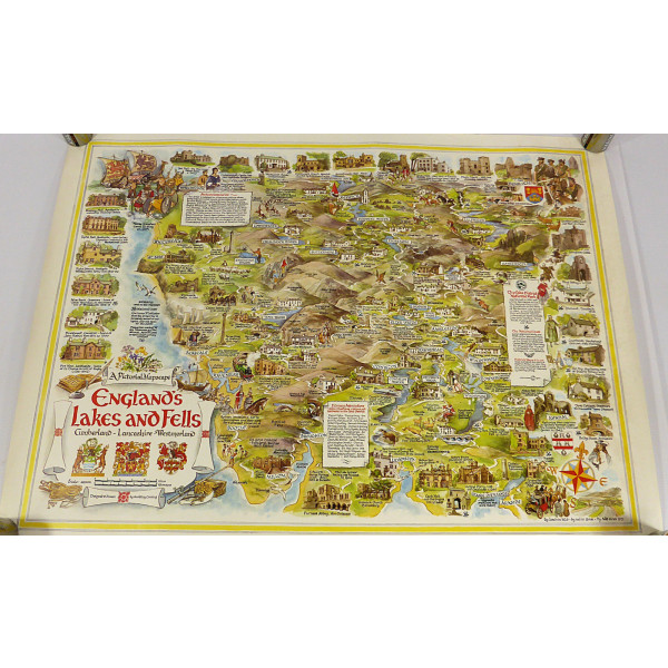
Geoffrey Coning pictorial map of England's Lakes & Fells.
Please note that this map was donated used so may show signs of age and use. There is some wear in places but overall it is in good condition.
The map has been stored in a cardboard tube.
The map features the historic counties of Cumberland, Lancashire, and Westmorland which made up the Lake District.
The image was drawn by Geoffrey Coning and published in London by Frederick Warne in 1973.
The map measures approximately 64cms x 49cms.
Please see the photos for more details.
GA Ref:
Ref: WHS/A17
Listed by: CL
Oversized/heavier packages (over 2kg) may be sent via courier.
PLEASE NOTE: Our online items are not kept in our shops. Viewing and/or collection from our Kendal Warehouse can be organised by prior arrangement . Please message to arrange.
For ‘Collection Only’ items or viewing, please allow a minimum of 24 hours notice - we will contact you by email when your item is ready for collection/viewing.
*For larger items (over 10Kg or measuring more than 61cm x 46cm x 46cm), please message us for a postage quote if you live in Ireland or the Scottish Islands as these deliveries are classed as "offshore" by DPD.
POST – Due to staff availability, we normally despatch postal items on Mondays, Wednesdays, & Fridays only.
We aim to respond to messages as soon as possible, but please note that our office opening hours are 9:00am-4:30pm Monday to Friday only.
Thank you for looking.
Every penny you spend on the items we list is used to help Age UK South Lakeland provide the much-needed support and services needed by the older people of South Lakeland.