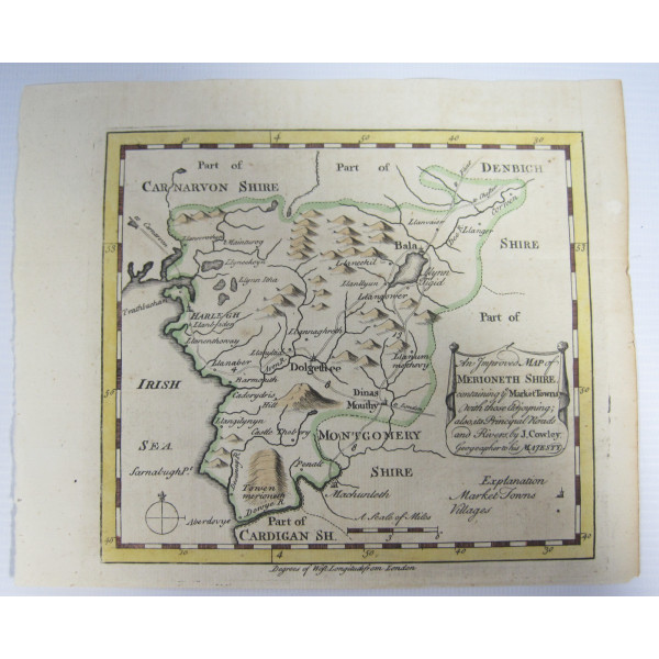
Antique Map of Merioneth Shire by John Cowley Hand Coloured Wales Map Circa 1744
Antique Map of Merioneth Shire by John Cowley Hand Coloured Wales Map Circa 1744
This item was donated in good condition for its age. Some fraying on the papers edges. The item was donated in (unsealed) plastic, resting on some cardboard for protection.
The message on the map, shown in picture 3, reads:
"An Improved Map of Merioneth Shire, containing the Market Towns, with those adjoining; also its Principal Roads and Rivers", by J. Cowley, Geographer to His Majesty."
Approx. size of the map: 19.8cm x 16.3cm
Published by Robert Dodsley
Please see photos for further details.
Our GA Ref:
Shop: MIL/D17
Listed by: KC
Thank you for looking. Every penny you spend on the items we list is used to help Age UK South Lakeland provide the much needed support and services needed by the older people of South Lakeland.